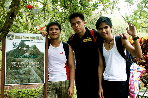
According to the locals, the name of Mt.
Batulao is literal derive with its natural characteristics, when sun rays
touches the mountain’s peak in the afternoon, as if the mountain is glowing in
the day light. “Bato sa Ilaw” as they say. A
little bit of trivia
GOING
BACK:
From Buendia (LRT Station), we took a bus
bound to Nasugbu, Batangas (Jam Liner) for 132 pesos (one way) and we’ve asked
the conductor to drop us at Evercrest Golf Course. From there, we’ve start our
journey.
From more than 10 young energetic hikers
we’re now trim down to three devoted mountaineers, ready to explore Mt.
Batulao.
From the baseline of the mountain, there
are markings 1 to 10. Cool
Unique idea to install wooden signage to
mark the trail for hikers like us.
At a distance, the peak is covered by the
clouds and I’m excited to kiss it!
 |
| First | touch down |
At peak 8, we’ve registered and paid 20
pesos for environmental fee. Also, it’s a wide campsite for hikers but we
intended to reach the highest point of Batulao and set up our tent there. Continue trekking
As we progress the climb, the path was getting
stiff. We also need to cross a nearby forest and climb beneath a cliff, one
wrong move and you’re doom!
The path was getting tougher, we needed to
traverse a 3 meters path at both ends were treacherous precipice. Pray
One by one we took turns to pass the said
trail. Success!
And we’re almost at the top!
And after a few minutes, we’ve reached the
highest point of Nasugbu. Batangas with 360 degree panoramic view. Superb
I’ve
seen Mt. Talamitam, Banahaw. And other mountains as well as the beach below. Relaxing!
Just
in time, we’ve set up our tent and cook food for our dinner. Sharing
While
eating we’ve experienced the sunset and the passing of clouds in our hands.
We
immediately headed inside our tent because of the cold weather and the most
unexpected event happened. Heavy drops of the rain and smashing winds distract
our night. We had no choice but to dry the base of tent and move our belongings
in the middle.
And
I felt that I’m freezing. So cold. Hoping the night would end soon.
Early
in the morning, we've pack up our things properly to descend in the old trail. The
day after we’ve managed to hike the new trail easily and the challenge would be
today – going down.
There’s
no sun because of the massive clouds around us.
 |
| old trail campsite | Credits to Arem Gelogo |
One
two three… and we started our trekking. The most challenging climb to date. We rappelled
almost 20 feet without security harness attached in our body. Beneath us – never
mind. Just don’t look.
Astonishing
view around us as we continue trekking. We’ve reached the campsite of the old
trail and paid 20 pesos (again).
After
a few yards away from the campsite, we’ve heard yelling people but the message
was unclear. We continue walking and suddenly we felt that we’re lost. Pray
We’ve
lost track with the trail and we just persist our journey towards the unknown
path. After 5 long hours without eating and empty bottle in our bags. We’ve
reached a familiar road. Safe
 |
| Chillax |
We’ve
rested in a near house and bought fresh buko to drink and shared the tails of
our adventure in the old trail. Lucky us, we’ve managed to escape the forest before
sunset. According to the owner of the Kubo, lots of mountaineers had lost in
the old trail and it’s one of the reasons why it is being closed for the mean
time. New trail ongoing.
We
changed clothes and ate our late lunch in the near sari sari store. Paul
suggested to us to visit the near Chapel before going home. We’ve stayed there
for a while and after a small chitchat. We call it a day.That marks our Batulao
adventure, one of the most memorable climb to date.
NOTE:


.jpg)


No comments:
Post a Comment